Sensors installed on the animals are taking oceanographic research to parts of the ocean scientists can’t otherwise reach
What you need to know:
- Sharks as mobile weather stations: Scientists use sharks equipped with CTD sensors to map temperature, depth, and salinity in hard-to-reach areas, helping them better understand hurricane intensity.
- Near real-time satellite transmission: The tags log data during dives and can only transmit it when the shark surfaces — since satellite radio signals are heavily attenuated by saltwater.
- Pit-stop-style tagging: Attaching the devices takes less than five minutes and uses self-degrading materials, allowing the sensor to detach naturally with time.
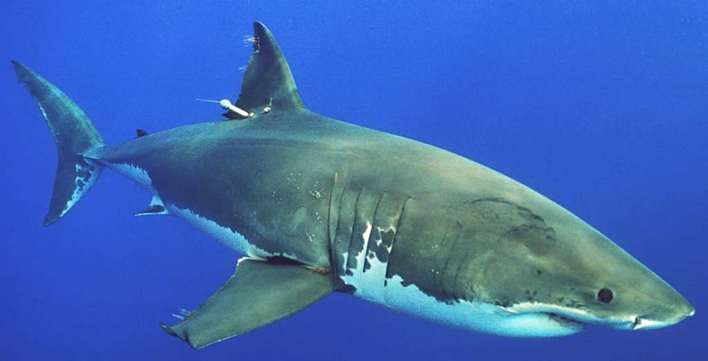
Researchers at the University of Delaware are developing an innovative way to monitor ocean conditions: using live sharks as true mobile observers of the marine environment.
How the Tags That Turn Sharks Into Sensors Work
To do this, the animals are fitted with CTD tags — small devices equipped with sensors that measure temperature, depth, and the water’s conductivity. Conductivity, in particular, helps scientists determine the ocean’s salinity.
As the sharks swim and dive, the sensors record this information across different regions and depths.
When a shark returns to the surface, the tag transmits the data to satellites, allowing researchers to receive the information in near real time. That’s because satellite radio signals are heavily weakened by salt water — which is why the antenna needs to be exposed to open air to send the data.
In practice, this means the sharks aren’t tracked continuously. Instead, they act as mobile platforms, gathering measurements at different points across the ocean as they move.
How the Ocean Shapes Hurricane Intensity
One of the initiative’s main goals is to gather information about the upper layer of the ocean, known among oceanographers as the mixed layer. This region acts as a kind of heat reservoir for the atmosphere.
Since that heat fuels hurricanes, a warmer mixed layer can contribute to the development of more intense storms, according to marine scientist Aaron Carlisle, who leads the research at the University of Delaware.
Researchers also hope to gather data on what’s known as the Mid-Atlantic Cold Pool, a seasonal layer of colder water found at greater depths — information that could help explain how different ocean layers influence how quickly hurricanes intensify.
Beyond contributing to hurricane research, the data collected by the sensors could also expand our understanding of the marine environment. Information on temperature, depth, and other water characteristics, combined with data on the sharks’ movements, could help researchers better understand the animals’ habitat and behavior, including identifying possible feeding and breeding grounds.
Why Sharks, and Not Other Marine Animals
Using animals to collect oceanographic data isn’t new — oceanographers have long used sensors on marine animals, especially elephant seals in polar regions. What’s new here is exploring sharks as mobile data-collection platforms in other parts of the ocean.
According to Carlisle, sharks offer some key advantages: they’re abundant, cover large areas, and can be more accessible to researchers than many protected marine mammals.
The team prioritizes species that surface often enough to allow the tags to transmit data, such as the shortfin mako shark, the blue shark, the smooth hammerhead shark, and juvenile great white sharks.
What a Tagging Expedition Looks Like in the Middle of the Ocean
To carry out the research, the team heads out on a research vessel and sets baited lines roughly 30 to 40 miles off the Atlantic coast, typically waiting two to three hours for a shark to bite.
Once an animal is caught, the tagging process begins under institutional animal-care oversight. “The tagging process itself works like a pit crew in a car race,” Carlisle said, noting that the procedure usually takes less than five minutes.
The tag is attached to the dorsal fin, and the animal undergoes a health assessment before being released back into the ocean. To keep the device from staying attached indefinitely, the tags use materials engineered to break down over time and eventually detach on their own.
From Numbered Tubes to Satellites: How Shark Tagging Has Evolved
Today’s technology represents decades of progress over traditional tagging methods. In the past, many tags were simple numbered tubes attached to a dart: scientists would release the fish and rely on another fisherman to catch it again and report the tag.
That method only revealed where an animal had been tagged and where it was later found — with no information at all about the route it took between those two points.
The Limits of an Essential Technology
Even though they represent a major leap forward in collecting data on both the animals and the deep ocean, electronic tags do have limitations and don’t reveal a shark’s exact route. Even so, the combined use of these sensors has established sharks as important “mobile observers,” capable of reaching parts of the ocean that are difficult and costly to monitor with conventional ships and equipment.
Sources and References
- University of Delaware – Media Experts Spotlight: https://www.udel.edu/faculty-staff/media-experts/spotlight/
- NOAA / U.S. IOOS – Animal-Borne CTD Tag Project: https://ioos.noaa.gov/project/ott-animal-borne-ctd-tag/
- University of Maine News – Can scientists track sharks in real time?: https://umaine.edu/news/2026/07/can-scientists-track-sharks-in-real-time-a-umaine-researcher-explains/
- Reuters – Scientists turn to sharks to improve hurricane predictions: https://www.reuters.com/business/environment/scientists-turn-sharks-improve-hurricane-predictions-2026-08-08/
- University of Delaware (UDaily) – Shark scientists, weather and ocean animal tracking: https://www.udel.edu/udaily/2025/july/shark-scientists-weather-ocean-animal-tracking-atlantic-ocean/